"Study sites: spatial pattern evaluation in hydrology"
http://space.geus.dk/sites/index.html
Print date: Thursday, July 3 2025 - 7:03
Page last modified: June 13, 2016
© SPACE space.geus.dk
|
|
Printer friendly version of the page: "Study sites: spatial pattern evaluation in hydrology" http://space.geus.dk/sites/index.html Print date: Thursday, July 3 2025 - 7:03 Page last modified: June 13, 2016 © SPACE space.geus.dk |
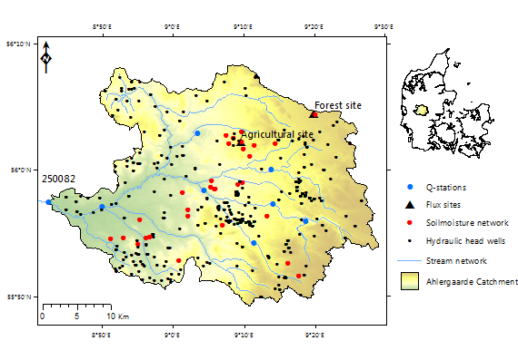
The 1,050 km2 Ahlergaarde catchment (the upstream part of the Skjern River) serves as the research catchment of the Danish Hydrological Observatory HOBE. The catchment is highly instrumented for state-of-the-art hydrological monitoring including, eddyflux towers, wireless soil moisture sensor network and cosmic ray sensors. Through the HOBE project, hydrological models of the catchment are available for the SPACE project. These models will be utilized in a multi-constraint framework including spatial patterns of simulated land surface temperature.
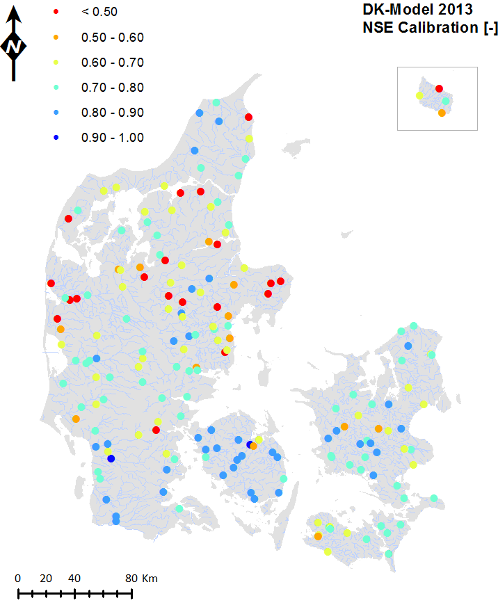
The National water resources model of Denmark developed and operated by the National Geological Survey of Denmark and Greenland (GEUS) is a coupled surface groundwater model. The national model covers the 43,000 km2 land area of Denmark and is used extensively for water resources management and implementation of the EU water framework directive. In the SPACE project the simulated spatial patterns of groundwater controlled surface fluxes of the national water resources model will be evaluated against hydrological functional units derived from time series analysis of thermal satellite remote sensing images.
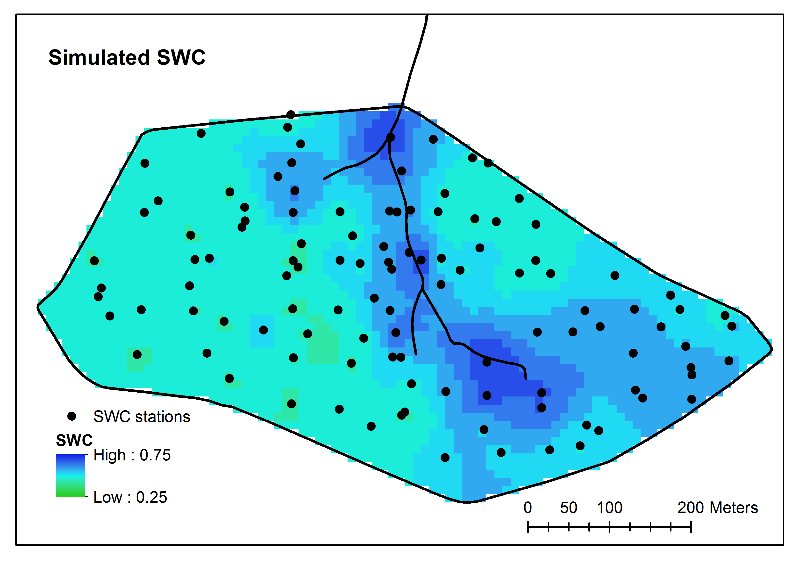
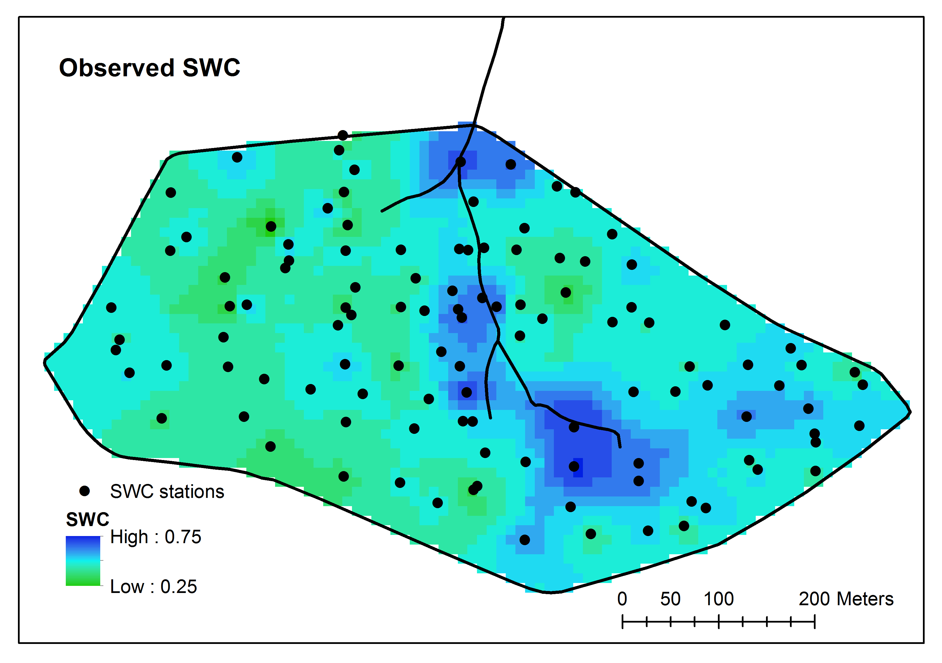
The Wüstebach catchment is a 3.8 ha research catchment and part of the German Hydrological Observatory TERENO.
The catchment is highly instrumented with especially a very dense soil moisture sensor network. Within the SPACE project the Wüstebach catchment is utilized to evaluate the spatial patterns of simulated soil water content.